

 Tonk District Map With Tehsil")
Tonk District – (28-12-2024) www.MapsOfRajasthan.com
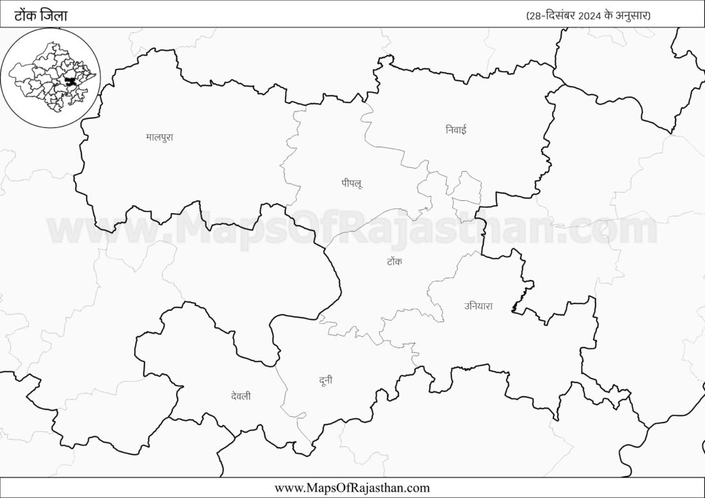
Tonk is situated in North Easternof Rajasthan, between 25°41’ and 26°34′ north latitudes and
between 75°07′ and 76°19′ east longitudes.It is bounded in the north by Jaipur district, in the
south by Bundi and Bhilwara districts, in the west by Ajmer district and in the east by Sawai
Madhopur district.
The history of Tonk Dictrict
The history of Tonk is very old as it is connected with Bairath culture. It was known as
SAMWAD LAKSHYA in Mahabharat period. The region was under mauryas then it was
merged in to Malvas. Later most of the region was part of Harsh Vardhan empire.
In the regime of Rajputs, the parts of this state were under Chavras, Solankis, Kachvahs,
Sisodiyas and Chouhans.
Later during Mughal period, Jaipur’s King Man Singh conquered
Tari &TokraJanpad in the regime of Akbar. In 1643 twelve village of Tokrajanpad were
given to Bhola Brahmin. Later Bhola gave a name to these twelve villages as ‘Tonk’.
Later, it was under the regime of King Holkar and Sindhia. In 1806, Amir Khan conqurred it
from Balvant Rao Holkar. Later, British government gained it from Amir Khan. As per the
treaty of 1817, British government returned it to Amir Khan.ON 25th March 1948, when
Nawab Mohd. Ismile Ali Khan was the ruler; Tonk was merged in to Rajasthan including an
area of Tonk and Aligarh Tehsils of old Tonk State Newai. Malpura, Toda Raisingh and
Uniara of Jaipur State, Deoli of Ajmer, Marwar and 27 villages of Bundi.
Tonk Distrct Stats
According to the Census of 2011, the district of Tonk has a population of 36,87,165 out of
which 1923928 are males and 1763237 are females. It accounts for 5.38percent of the State
population. The Geographical area of the district is 7194 sqkmwhich is 6.68percent of the
total state area.
The district ranks 23rdin terms of population and 18thin terms of areaand19thin
terms of population density among all districts of the state.
Tonk district has the shape of kite or rhombus with its eastern and western sides bending
some what inward and the south-eastern portion protruding between Sawai Madhopur and
Bundi districts. The district is flat at a general elevation of about 214.32 meters above sea
level with rocky but scrubby hills