
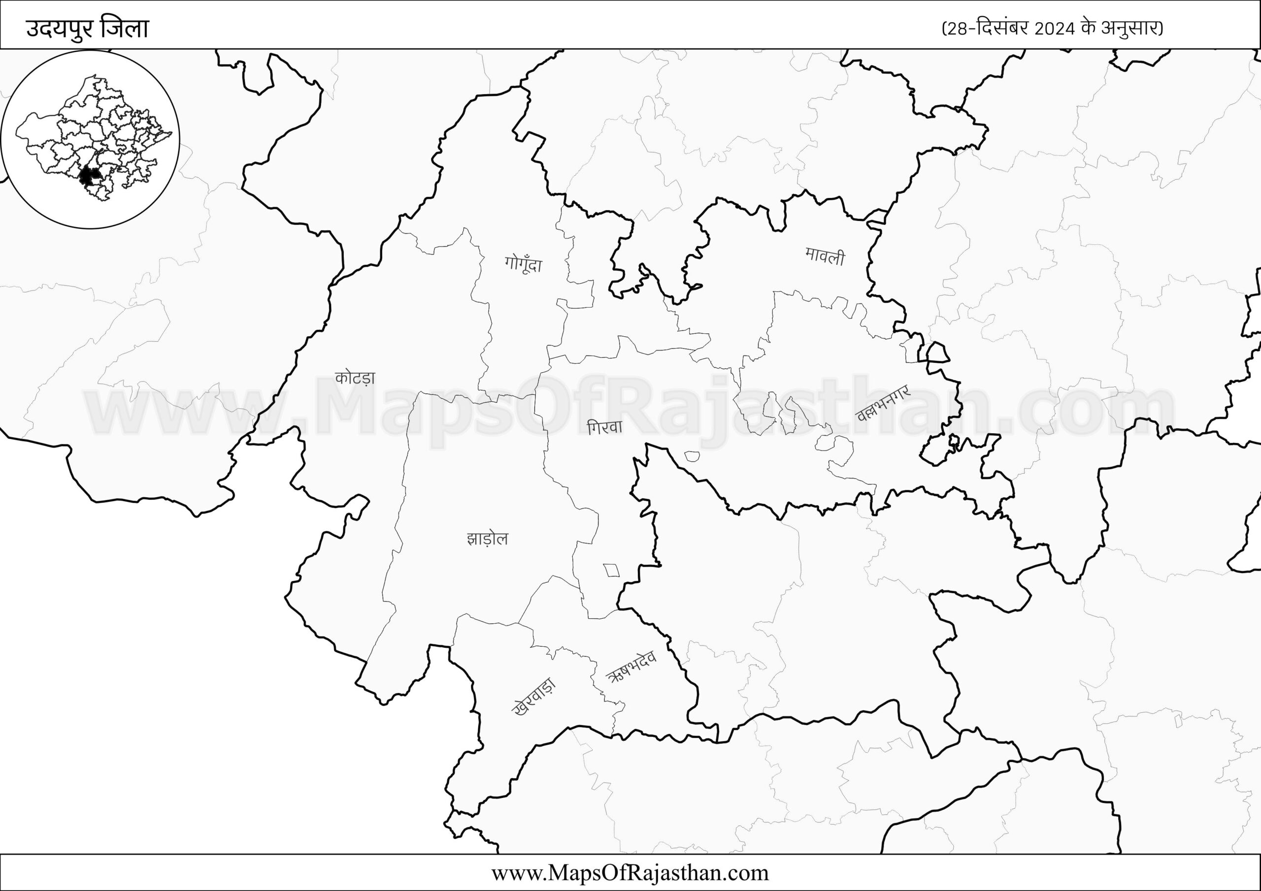
Udaipur District Map with Tehsil Boundaries
Udaipur District – (28-12-2024) www.MapsOfRajasthan.com
Udaipur District map with Tehsil boundaries
Udaipur District has following Tehsils
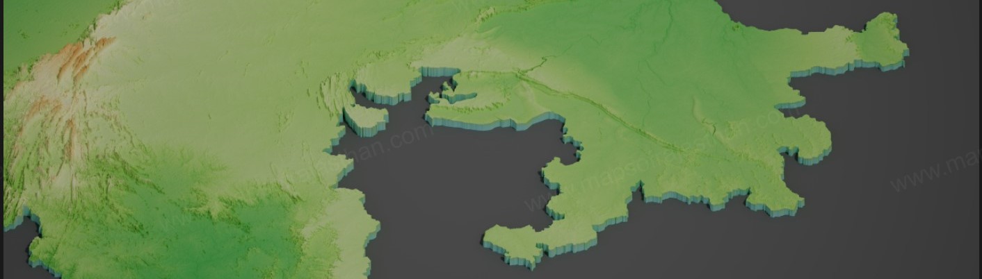
Udaipur District 3D Rendered Map
Udaipur is a district in the Rajasthan State of India. The total area of Udaipur district is 11,724 km², which includes 11,543.39 km² of rural area and 180.61 km² of urban area. There are about 2,471 villages in Udaipur district.
For administrative convenience, Udaipur district is divided into Tehsils, Blocks, PS, and Community Development Blocks (C.D. Blocks). In many states, Blocks or C.D. Blocks are treated the same as tehsils, though they may have slightly different roles depending on the region.
A Community Development Block is a rural area set aside for administration and development. Each block is managed by a Block Development Officer (BDO) and includes several gram panchayats, which are the local governing bodies at the village level.
There are 11 tehsils in Udaipur district. Here is the list of all Udaipur Tehsils / Blocks / C.D.Blocks along with area & population information.
Largest & Smallest Tehsils
Girwa is the largest tehsil in udaipur district by both area and population. Lasadiya is the smallest tehsil in udaipur district by both area and population.
| Particulars | Area | Population |
|---|---|---|
| Lartest Tehsil | Girwa | Girwa |
| Smallest Tehsil | Lasadiya | Lasadiya |
Population of Udaipur District
The population of Udaipur offers a clear picture of how people are spread across its villages and towns. In the sections below, you’ll find details about total population, gender-wise distribution, child population, literacy rates, social groups like SC and ST, household count, and population density. Together, this information helps understand the structure and diversity of the district.
Basic Population Details
This section covers important demographic figures of Udaipur, including the number of males and females, children aged 0–6, total households, and literacy status in rural and urban areas. These indicators highlight the human development status and help identify gaps in basic services like education and housing.
| Particulars | Total | Rural | Urban |
|---|---|---|---|
| Total Population | 30,68,420 | 24,59,994 | 6,08,426 |
| Total Male Population | 15,66,801 | 12,51,316 | 3,15,485 |
| Total Female Population | 15,01,619 | 12,08,678 | 2,92,941 |
| Child Population (Age 0–6) | 5,08,550 | 4,41,482 | 67,068 |
| Male Child Population (Age 0–6) | 2,64,321 | 2,28,369 | 35,952 |
| Female Child Population (Age 0–6) | 2,44,229 | 2,13,113 | 31,116 |
| Literate Population | 15,82,629 | 11,08,846 | 4,73,783 |
| Literate Male Population | 9,73,444 | 7,12,379 | 2,61,065 |
| Literate Female Population | 6,09,185 | 3,96,467 | 2,12,718 |
| Illiterate Population | 14,85,791 | 13,51,148 | 1,34,643 |
| Illiterate Male Population | 5,93,357 | 5,38,937 | 54,420 |
| Illiterate Female Population | 8,92,434 | 8,12,211 | 80,223 |
| Households | 6,23,531 | 4,95,973 | 1,27,558 |
Here’s a detailed summary of Basic Population Details of Udaipur district based on Census 2011:
- Total population of Udaipur district is 30,68,420, including 15,66,801 males and 15,01,619 females. In rural areas, it is 24,59,994, including 12,51,316 males and 12,08,678 females. In urban areas, it is 6,08,426, including 3,15,485 males and 2,92,941 females.
- Child population (0–6 years) in Udaipur district is 5,08,550, including 2,64,321 boys and 2,44,229 girls. In rural areas, it is 4,41,482, including 2,28,369 boys and 2,13,113 girls. In urban areas, it is 67,068, including 35,952 boys and 31,116 girls.
- Literate population in Udaipur district is around 15,82,629, including 9,73,444 males and 6,09,185 females. In rural areas, it is 11,08,846, including 7,12,379 males and 3,96,467 females. In urban areas, it is 4,73,783, including 2,61,065 males and 2,12,718 females.
- Illiterate population in Udaipur district is about 14,85,791, including 5,93,357 males and 8,92,434 females. In rural areas, it is 13,51,148, including 5,38,937 males and 8,12,211 females. In urban areas, it is 1,34,643, including 54,420 males and 80,223 females.
- There are about 6,23,531 households in Udaipur district, including 4,95,973 in rural areas and 1,27,558 in urban areas.
Social Structure and Density
This part highlights the distribution of Scheduled Caste (SC) and Scheduled Tribe (ST) populations within Udaipur. It also includes data on how densely people live in rural versus urban areas. Together, these figures offer insights into community spread and the pressure on local infrastructure and services.
| Particulars | Total | Rural | Urban |
|---|---|---|---|
| Total SC Population | 1,88,525 | 1,22,385 | 66,140 |
| SC Male Population | 97,094 | 62,733 | 34,361 |
| SC Female Population | 91,431 | 59,652 | 31,779 |
| Total ST Population | 15,25,289 | 14,83,035 | 42,254 |
| ST Male Population | 7,73,213 | 7,51,109 | 22,104 |
| ST Female Population | 7,52,076 | 7,31,926 | 20,150 |
| Population Density | 262 / km² | 213 / km² | 3,369 / km² |
Here’s a detailed summary of the social structure and population density of Udaipur district based on Census 2011:
- Scheduled Caste (SC) population in Udaipur district is approximately 1,88,525, including 97,094 males and 91,431 females. In rural areas, it is 1,22,385, including 62,733 males and 59,652 females. In urban areas, it is 66,140, including 34,361 males and 31,779 females.
- Scheduled Tribe (ST) population in Udaipur district is about 15,25,289, including 7,73,213 males and 7,52,076 females. In rural areas, it is 14,83,035, including 7,51,109 males and 7,31,926 females. In urban areas, it is 42,254, including 22,104 males and 20,150 females.
- Overall population density of Udaipur district is around 262 people per km². Rural areas have about 213 people per km². Urban areas have about 3,369 people per km².
